Property Record
3500 Jefferson Rd, Athens, GA 30607
NEARBY LISTINGS FOR SALE OR LEASE
-
-
View all Athens listings for lease on LoopNet.com
Property Detail
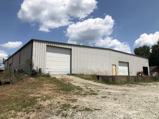
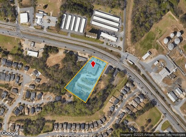
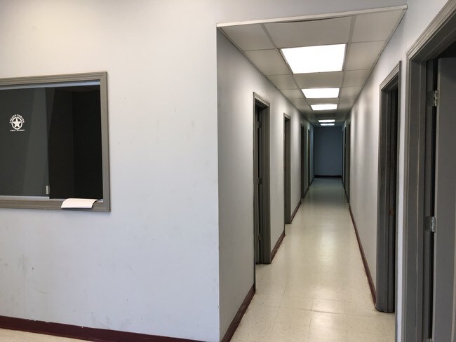
3500 Jefferson Rd
111A-099-B
Com-St-058->00-03
Publicstorage
Clarke
X
Georgia
13059C0014E
2.58 AC
2025
Westside Athens
2025
Other Market Areas
130400
Athens-Clarke County, GA
10,000 SF
DEMOGRAPHICS near 3500 Jefferson Rd
1 Mile
3 Mile
5 Mile
2024 Total Population
4,929
30,677
89,749
2029 Population
4,956
30,835
90,808
Pop Growth 2024-2029
+ 0.55%
+ 0.52%
+ 1.18%
Average Age
38
37
35
2024 Total Households
1,789
12,449
34,850
HH Growth 2024-2029
+ 0.67%
+ 0.52%
+ 1.12%
Median Household Inc
$64,711
$53,426
$49,462
Avg Household Size
2.60
2.30
2.20
2024 Avg HH Vehicles
2.00
2.00
2.00
Median Home Value
$221,593
$253,359
$271,530
Median Year Built
1981
1978
1984
Nearby Places
Map Layers
Map Styles
 Street
 Aerial
- Restaurants
- Banks
- Shops
- Fitness
- Groceries
SALE & LEASE HISTORY
LISTING DATE
SALE/LEASE

Aug 22, 2019
For Lease
Nearby Properties
Address
Land Use
TOTAL SIZE
Lot Size
Zoning
Address
Land Use
TOTAL SIZE
Lot Size
Zoning
11.36 AC
G
Address
Land Use
TOTAL SIZE
Lot Size
Zoning
85,608 SF
63.75 AC
RM-2
Address
Land Use
TOTAL SIZE
Lot Size
Zoning
56.15 AC
G
Address
Land Use
TOTAL SIZE
Lot Size
Zoning
18.47 AC
C-G
Address
Land Use
TOTAL SIZE
Lot Size
Zoning
112,071 SF
5.27 AC
E-O
Address
Land Use
TOTAL SIZE
Lot Size
Zoning
66,200 SF
13.35 AC
G
Address
Land Use
TOTAL SIZE
Lot Size
Zoning
77,919 SF
8 AC
E-I
Address
Land Use
TOTAL SIZE
Lot Size
Zoning
1,672 SF
23.70 AC
RM-2
Address
Land Use
TOTAL SIZE
Lot Size
Zoning
9,956 SF
7.20 AC
E-O(PD)
Address
Land Use
TOTAL SIZE
Lot Size
Zoning
49.58 AC
G
Address
Land Use
TOTAL SIZE
Lot Size
Zoning
88,251 SF
8.16 AC
C-G
Address
Land Use
TOTAL SIZE
Lot Size
Zoning
10,490 SF
5.16 AC
C-G
Address
Land Use
TOTAL SIZE
Lot Size
Zoning
2,602 SF
9.95 AC
C-G
Address
Land Use
TOTAL SIZE
Lot Size
Zoning
58,706 SF
12.86 AC
C-G
Address
Land Use
TOTAL SIZE
Lot Size
Zoning
26.86 AC
G
Address
Land Use
TOTAL SIZE
Lot Size
Zoning
32,000 SF
4.35 AC
C-G
Address
Land Use
TOTAL SIZE
Lot Size
Zoning
20.74 AC
G
Address
Land Use
TOTAL SIZE
Lot Size
Zoning
3,223 SF
17.81 AC
RS-5
Address
Land Use
TOTAL SIZE
Lot Size
Zoning
19.21 AC
G
Address
Land Use
TOTAL SIZE
Lot Size
Zoning
4,148 SF
7.04 AC
RM-1
Address
Land Use
TOTAL SIZE
Lot Size
Zoning
11,890 SF
6.60 AC
C-G
Address
Land Use
TOTAL SIZE
Lot Size
Zoning
664,513 SF
84.46 AC
I
Address
Land Use
TOTAL SIZE
Lot Size
Zoning
106,760 SF
10.38 AC
E-O
Address
Land Use
TOTAL SIZE
Lot Size
Zoning
44,563 SF
18.32 AC
C-G
Address
Land Use
TOTAL SIZE
Lot Size
Zoning
5 AC
RM-2
Address
Land Use
TOTAL SIZE
Lot Size
Zoning
8.27 AC
G
Address
Land Use
TOTAL SIZE
Lot Size
Zoning
1.25 AC
G
Address
Land Use
TOTAL SIZE
Lot Size
Zoning
86,128 SF
5.52 AC
C-G
Address
Land Use
TOTAL SIZE
Lot Size
Zoning
88,335 SF
5.26 AC
C-G
Address
Land Use
TOTAL SIZE
Lot Size
Zoning
39.94 AC
C-O
The World's #1 Commercial Real Estate Marketplace
Connect with us
© 2025 CoStar Group
The information above has been obtained from sources believed reliable. While we do not doubt its accuracy we have not verified it and make no guarantee, warranty or representation about it. It is your responsibility to independently confirm its accuracy and completeness. Any projections, opinions, assumptions, or estimates used are for example only and do not represent the current or future performance of the property. The value of this transaction to you depends on tax and other factors which should be evaluated by your tax, financial, and legal advisors. You and your advisors should conduct a careful, independent investigation of the property to determine to your satisfaction the suitability of the property for your needs.